United Kingdom is a group of countries located off the northwestern coast of Continental Europe. Originally it was a series of smaller kingdoms. To understand why this one country includes four countries we need to look at the history.
Time Line United Kingdom
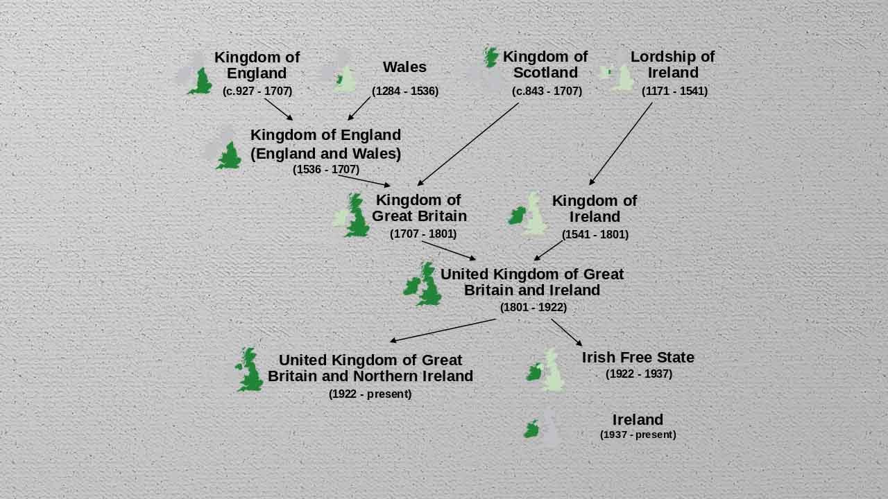
- 1536: England initiated a unification process when it asserted control over Wales in the 16th Century.
- 1603: The English and Scottish crowns joined to form a single monarchy in 1603.
- 1707: Kingdom of Scotland joined the Kingdom of England (England and Wales)
- 1801: The Kingdom of England united with the Kingdom of Ireland to form the United Kingdom
- 1937: Ireland gained Independence from the United Kingdom.
Historically, Monarchs ruled the region, but the power has steadily shifted to the Parliament. Today, the UK’s parliament is said to be the most powerful parliament in the world.
United Kingdom Fact Sheet
| Area | 243,610 km² |
| Population | 68 Million |
| Population Density | 279 people / km² |
| Language | English |
| Major Religion | Christianity |
| Political System | Unitary Parliamentary System under Constitutional Monarchy |
| Currency | Pound Sterling |
Physical Geography of the United Kingdom
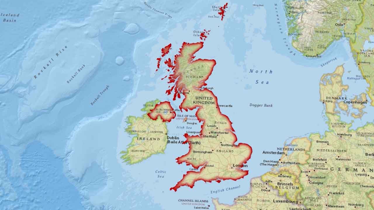
The biggest part of the United Kingdom is the island of Great Britain which consists of 3 countries – England, Wales and Scotland.
The UK also includes Northern Ireland which is on another island altogether i.e. Ireland.
Scotland and Wales are mostly mountainous with sharp ridges and deep valleys.
20000 years ago, the terrain was covered by ice sheets, when ice melted what was left behind was lakes locally called Lochs.
The UK’s largest lake by surface area is Lough Neagh, located in Northern Ireland.
River Severn
River Severn is the longest river with 354 km in length. It originates in Wales and the Bristol Channel.
River Thames
It is the second-longest river in the UK and the longest in England. It flows for 273 km before draining into the North Sea. The capital city, London is located along the River Thames. This river is important for trade and navigation.
Important Water Bodies Surrounding the UK
The North Atlantic Ocean to the North, the North Sea to the East, the English Channel to the South, the Irish Sea and the Celtic Sea between Great Britain and Ireland are important waterbodies surrounding the UK.
Why does the United Kingdom have such a good geography?
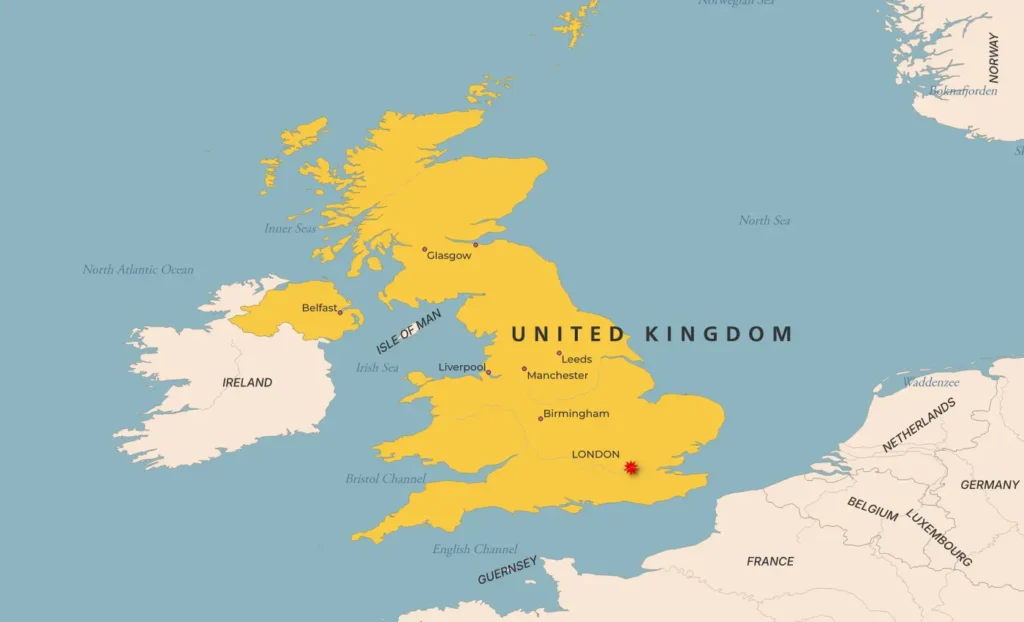
Located off the northwest coast of Europe, the United Kingdom includes 4 countries — England, Scotland, Wales, and Northern Ireland.
England, Scotland and Wales are part of the island of Great Britain, whereas Northern Ireland lies on another island sharing a border with an entirely separate country of Ireland.
In times of war, the UK thanked its geography. The waters around the island provided natural protection, and the timber found on it allowed the UK to build a great navy.
Coal, Iron and suitable economic conditions sparked the Industrial Revolution. All this allowed the UK to control 22% of the earth at its peak.
However, in the current geopolitical scenario, the British have only a collective memory of greatness and remain well within Europe yet outside of it.
The global power of the United Kingdom declined during the 20th century but still, it remains one of the wealthiest and most populous nations in the world.
Watch on Instagram
Read More: Geography of USA
Difference between the United Kingdom, England and Great Britain
Most of you know this area as shown on the map as Great Britain, the United Kingdom, and England, but what’s the difference between them? Well, let’s break it down.
First, Great Britain and Ireland are geographical terms. These are the names of the two main islands.
The smaller island, Ireland, consists of two countries: Northern Ireland, which is part of the United Kingdom, and the Republic of Ireland, a separate country that’s part of the European Union.
The larger island is Great Britain, which is home to three countries: England, Scotland, and Wales. When people refer to England, they’re talking about just one country located in the southern part of this island of Great Britain.
Now, the United Kingdom, or UK, includes all of Great Britain—meaning England, Scotland, and Wales—plus Northern Ireland. So, the UK is not a geographical term but a political union of these four countries under one government.
The term British Isles refers to the geographic region that includes Great Britain, Ireland, and over 6,000 smaller islands.
So, to sum up:
- England is a country so are Scotland, Wales and Northern Ireland.
- Great Britain is an island
- The United Kingdom is a political union and a sovereign country that includes all of Great Britain and Northern Ireland.
Still confused? Well, I don’t blame you this one is a bit tricky. You can watch this one-minute short video which can make a difference clear: Click me to watch