


- Area: 468 square kilometres
- Population: 80,000
- Capital: Andorra la Vella
A hidden gem nestled in the mountains of Europe.
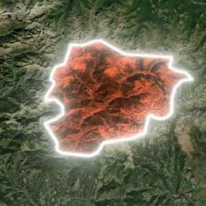
Andorra Map and Bordering Countries
Andorra is a small, landlocked country in southwestern Europe, located in the eastern Pyrenees mountains and bordered by Spain to the south and France to the north
Geography of Andorra
With a population of just 80,000 and an area of 468 square kilometres, this tiny principality offers a unique blend of breathtaking landscapes and rich cultural heritage.
History of Andorra
Andorra’s name likely derives from the Arabic “al-Darra” (the forest) or the Navarrese Basque “andurrial” (shrub-covered land). It became formalized in the 8th century and was officially recognized in the Paréage Agreement of 1278, establishing it as a co-principality. Today, it is known as the Principality of Andorra (Principat d’Andorra in Catalan).
know more about Australia
A hidden gem nestled in the mountains of Europe Watch now