


- Area: 29,743 sq km;
- Population: ~3 million;
- Capital: Yerevan.
- Geography: Mountainous, Mount Aragat’s highest peak, prone to earthquakes.
- Borders: Georgia, Azerbaijan, Iran, Turkey.
- Features: Canyons, extinct volcanoes.
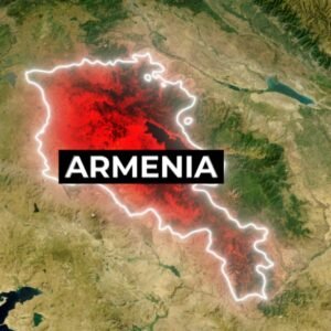
Armenia Map and Bordering Countries
Armenia is located south of the Caucasus Mountains, nestled between the Black Sea and the Caspian Sea, Armenia shares its borders with Georgia, Azerbaijan, Iran, and Turkey. This mountainous country boasts its highest peak at Mount Aragats, rising about 4,000 meters high.
Geography of Armenia
The landscape features fast-flowing rivers, canyons, and extinct volcanoes. Armenia is also prone to frequent earthquakes, with a devastating one in 1988 that claimed around 25,000 lives.
History of Armenia
Armenia takes us to the mountainous region of West Asia. Armenia is considered one of the oldest civilizations in the world. Its capital city is Yerevan. Covering an area of 29,743 square kilometres, Armenia is home to some 3 million people.
Interesting Facts about Armenia
The national fruit of Armenia is the apricot, which has grown in this country for at least 3,000 years
Armenia is considered one of the oldest civilizations in the world: Watch now
Read more
The sixth-largest country – Australia
A hidden gem nestled in the mountains of Europe – Andorra Country
One of the oldest civilizations in the world: Watch now