
- Area: 7,741,220 sq km
- Population: 25.5 million (Januar 2024)
- Capital: Canberra.
Australia Map and Bordering Countries
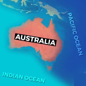
Australia is bordered by the Indian Ocean to the west and the Pacific Ocean to the east. Off its northeastern coast lies the Great Barrier Reef, the world’s largest coral reef.
Australia. Known as the largest island on Earth, Australia is the sixth-largest country, covering an area of 7,741,220 sq km with a population of 25.5 million. Contrary to popular belief, Canberra, not Sydney, is the capital of Australia.
know more about Austria
Geography of Australia
The country’s central region is dominated by deserts, surrounded by grasslands, rainforests, and mountains. The Murray and Darling are notable rivers. The Great Dividing Range is the world’s fifth-longest land-based mountain chain and that too entirely contained within a single country.
History of Australia
Aboriginals, the first people to settle in Australia, arrived around 50,000 years ago.
A hidden gem nestled in the mountains of Europe
An interesting Factor about Australia
Unique to Australia are marsupials, animals like kangaroos and koalas, which raise their young in pouches.
Know more about Australia
Angola is a big country in Africa.
Read about Antigua and Barbuda