


- Area: 86,600 sq km
- Population: 10.2 million.
- capital: Baku.
Bordering Countries of Azerbaijan
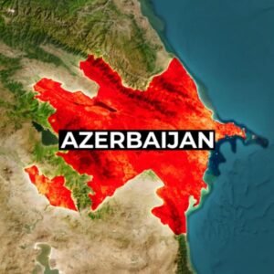
Azerbaijan is bordered by the Caspian Sea to the east, Iran to the south, Armenia to the west, and Georgia and Russia to the north. The Azeri autonomous republic of Nakhchivan is an enclave within Armenia, sharing a narrow western border with Turkey. Its highest peak is Bazarduzu Dagi, standing at 4,485 meters.
Geography of Azerbaijan
Rich in petroleum and natural gas, the country is using its resources to strengthen its military, a key focus for the government due to the conflict over the Nagorno-Karabakh region.
Azerbaijan is known as the ‘Land of Fire’ due to its unique phenomenon of burning gas seeping from the ground, sometimes blazing for years.
Azerbaijan Geography: Watch now
Algeria Geography: Watch now
know more about Australia
A hidden gem nestled in the mountains of Europe Watch now